ǀXam ve ǂXomani torpaqları
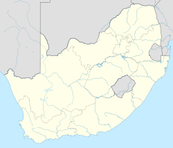
ǀXam [1][2][3][4][5][6] və ǂXomani torpaqları — Cənubi Afrika Respublikasının Şimali Burun vilayətində, Upinqton şəhərinin şimal və cənubunda yerləşən ərazilərdir. |Xam və ǂXomani xalqları Buşmen xalqının dil baxımından əlaqəli qrupları idlər.
| ǀXam ve ǂXomani torpaqları | |
| ǂKhomani Cultural Landscapeadı=ǂXomani mədəni landşaftı [* 1] | |
| Ölkə |
|
|---|---|
| Tip | Mədəni |
| Kriteriya | (v),(vi) |
| Keçid | 1545 |
| Region | Afrika [* 2] |
| Daxil edilməsi | 2017 (41-ci sessiya) |
|
|
|
Ərazinin təsviri
[redaktə | mənbəni redaktə et]Ərazi yuxarı Karu (cənub) və cənubi Kalaxarinin (şimal) yarı quru və quraq massivlərindən ibarətdir. Hər iki sahə, Son daş dövrünə aid arxeoloji izlərlə zəngindir. Cənub bölgəsindəki qaya təpələri petroqliflərin üstünlük təşkil etdiyi çox sayda qaya təsvirlərinə sahibdir.[7][8]
Ümumdünya irsi statusu
[redaktə | mənbəni redaktə et]ǀXam ve ǂXomani torpaqları 15 may 2004-cü ildə UNESCO-nun Müvəqqəti Ümumdünya irsi siyahısına əlavə edildi.[9]
Ərazinin şimalındakı ǂXomani mədəni landşaftı, 8 iyul 2017-ci ildə UNESCO-nun Ümumdünya irs komitəsinin Polşanın Krakov şəhərində baş tutan 41-ci iclası zamanı ümumdünya irsi statusu almışdır.[10]
İstinadlar
[redaktə | mənbəni redaktə et]- ↑ ǀXam rather than ǃXam is the correct spelling - see Barnard, A. 1992. Hunters and herders of Southern Africa: a comparative ethnography of the Khoisan peoples. Cambridge University Press.
- ↑ Bleek, W.H.I. & Lloyd, L.C. 1911. Specimens of Bushman Folklore. London: George Allen.
- ↑ Deacon, J. 1986. 'My place is the Bitterpits'. The home territory of the Bleek and Lloyd's |Xam San informants. African Studies 45: 135-155.
- ↑ Deacon, J. 1994. Rock engravings and the folklore of Bleek and Lloyd's ǀXam San informants. In T. A. Dowson, & Lewis-Williams, J.D. (ed.). Contested images: diversity in southern African rock art research, pp. 237-256. Johannesburg: Witwatersrand University Press.
- ↑ Lewis-Williams, J. D. 2000. Stories that float from afar: ancestral folklore of the San of Southern Africa. Cape Town: David Philip.
- ↑ Skotnes, P. 2007.Claim to the country: the archive of Lucy Lloyd and Wilhelm Bleek. Johannesburg: Jacana
- ↑ Deacon, J. & Foster, C. 2005. My heart stands in the hill. Cape Town: Struik Publishers.
- ↑ Parkington, J. Morris, D. & Rusch, N. 2008. Karoo rock engravings. Clanwilliam: Krakadouw Trust
- ↑ "The ǃXam Khomani Heartland - UNESCO World Heritage Centre". 2022-02-04 tarixində arxivləşdirilib. İstifadə tarixi: 2020-07-18.
- ↑ ǂKhomani Cultural Landscape inscribed as World Heritage https://www.environment.gov.za/mediastatement/khomaniculturallandscape_aworldheritagesite Arxivləşdirilib 2021-04-18 at the Wayback Machine


